Still mild, but little hope for sunshine before the next round of rain and snow arrive
We dealt with fog this morning, but conditions are slowly improving out there. As our day continues, some of our southern locations could see some clearing, but chances lessen the further north you do go. Daytime highs will likely top out in the mid to upper 30s, with a few of our southern locations potentially grasping the low 40s. Fog will be on the table yet later tonight, with overnight lows in the upper 20s.
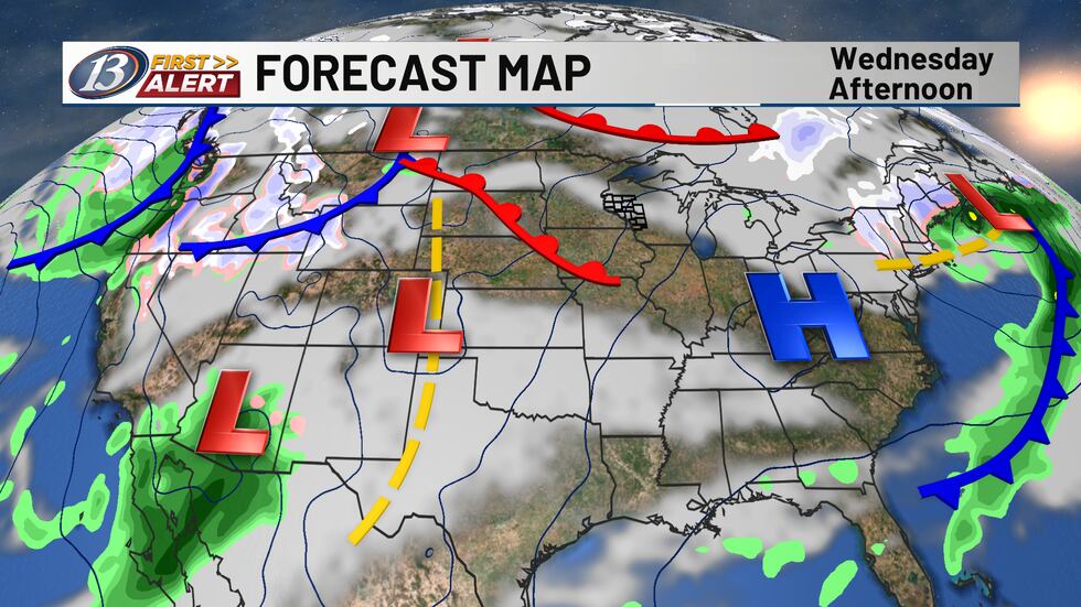
The flat upper level flow this week will begin to shift to more of a southwest flow through Thursday, keeping our temperatures above average. A disturbance within the flow will track into the Midwest, developing a wave of low pressure that is forecast to track across Illinois Thursday night. It has been trending northward at a faster pace over the last 24 hours or so, and it now appears some impacts can be expected in our area. Rain will arrive in southern counties by the noon hour, and up into the Chippewa Valley by the early evening. Daytime highs will again be in the mid and upper 30s, but as temperatures cool into Thursday night, the rain should transition over to some wet snow. Impacts look to remain low at this time with minimal accumulations, but it’s something we will be watching. Otherwise the work week ends with dry weather on Friday, with highs closer to freezing. A larger storm is then expected to develop over the Southern Plains while tracking up towards the Great Lakes. While the main low currently looks to stay farther south, a deepening upper trough to our west will hook up with more energy coming from the southwest, leading to a more expansive area of precipitation. Colder air will be in place and it now appears likely we will see some snow to start the weekend. We have put out a First Alert WATCH for accumulating snow Saturday with the potential for at least a couple inches. We will be watching trends over the next couple of days, giving you the latest information as it develops.
Copyright 2026 WEAU. All rights reserved.