Light accumulating snow Sunday followed by gusty winds and bitter cold to start the new week
Monday is a First Alert Weather Day
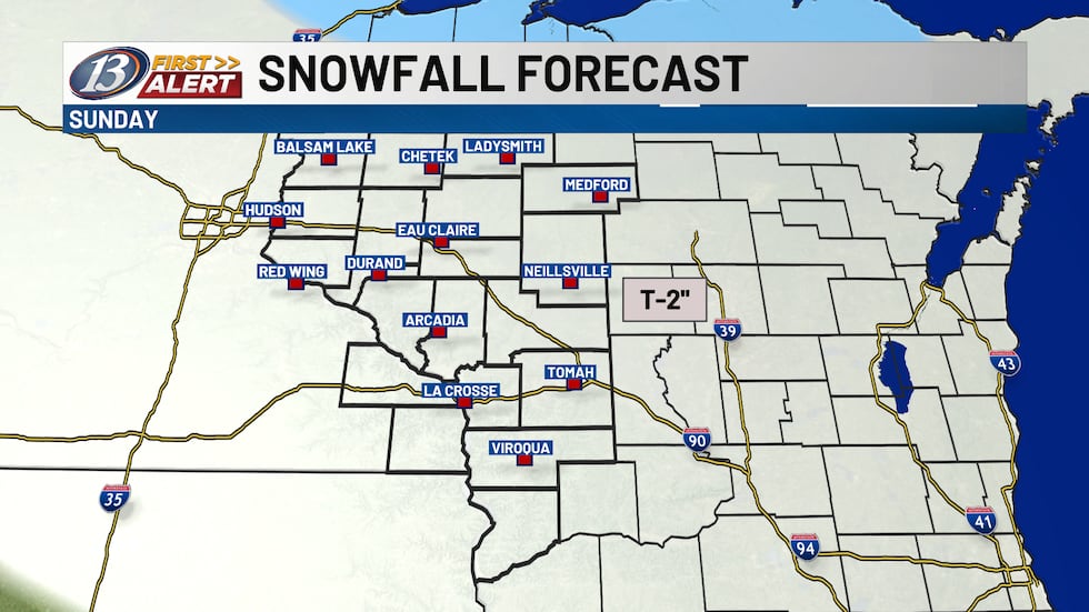
We’re seeing cloudy skies to start our day today. Our next clipper system is in the Dakotas/Minnesota, and this will bring in our next minor accumulating snowfall today. Some guidance is picking up on some dry air during the onset of the snow, but I do expect us to overcome that quickly. There doesn’t look to be a lot of moisture associated with the system, so overall snowfall amounts should remain light. A general trace to 2 inches can be expected.
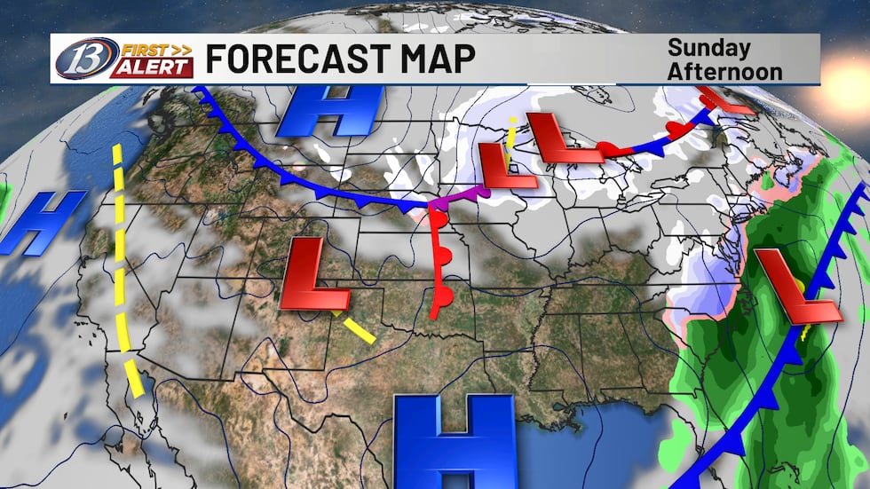
Snow will wrap up in the afternoon and evening as the low continues to exit. Behind the low and associated arctic cold front, substantial changes are in store. Temperatures will drop below zero Sunday night and will likely stay below zero throughout all of Monday. Northwesterly winds will be between 10-20 mph, with gusts upwards of 40 mph at times. This will allow for wind chill values to fall as low as-35 degrees below zero. Frostbite can occur in 30 minutes or less in these conditions!
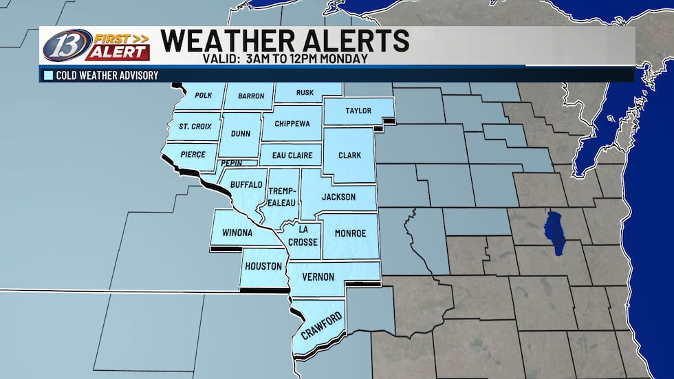
The National Weather Service has put out a Cold Weather Advisory from 3am to noon on Monday, and we have gone ahead with a First Alert Day kicking off Sunday night through Tuesday morning. While there will be some improvements late Monday and into Tuesday, wind chill values are still likely to be dangerously cold. While daytime highs will be back into the teens Tuesday through Thursday, our winter-like pattern won’t let up. There is slightly better agreement in another low-pressure system in association with a mid-level wave sliding to our south late Tuesday into Wednesday, bringing another round of accumulating snow. Much like Sunday’s system, amounts look to be relatively light at this time. An upper-level low will be to our north on Thursday and Friday, with another blast of arctic air into the weekend.
Copyright 2026 WEAU. All rights reserved.