Marching into meteorological spring with plenty of sunshine and our brief cooldown continuing
Clouds have been stubborn to erode across the Chippewa Valley, allowing for temperatures to start off in the teens as opposed to the single digits. Where there has been clearing, temperatures have been able to fall tremendously. High pressure can be found over northwestern Minnesota, and it should move over the upper Mississippi River Valley later this afternoon. We should begin to see this cloud deck move out in the coming hours. It’ll be a beautiful day to welcome in meteorological spring, but it will be chilly! Temperatures today will make it into the mid to upper 20s, nearly 5 to 10° below average. Light northwesterly winds with high pressure should make wind chill values not too much of an issue. Overnight lows tonight will tumble into the teens.
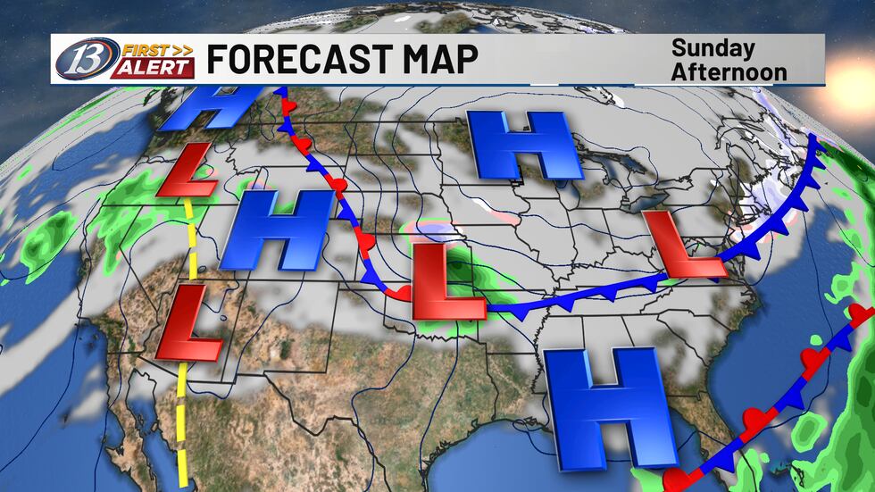
High pressure will exit into Monday, allowing the return of southerly flow and temperatures in the 30s! A low-pressure system to the south could bring a few flurries to the Chippewa Valley with a potential mix for the Coulee Region late Monday night before wrapping into Tuesday morning. Amounts look to be minimal at this time. Tuesday also brings the return of the 40s, which will continue for much of this upcoming week as our upper air pattern turns more southwesterly, usually indicating a more active weather pattern. Confidence in another round of precipitation is low into the overnight and into Wednesday with another small wave passing through, though the best chances near I-90 yet again. A warm front will hold over Southern Wisconsin on Thursday, likely bringing the warmest day of the week as temperatures climb into the upper 40s before another cold front dives down from the northwest. The passage will spark our next chance for some rain on Friday as temperatures fall into the low to mid 40s.
Copyright 2026 WEAU. All rights reserved.