Our mild stretch to continue with a widespread rain chance into Friday
After starting off with some sun in the Chippewa Valley, clouds are now taking hold as our next storm system starts to organize over the Plains. High temperatures will reach back above average to the low 50s. Overcast skies will take us into tonight, with showers and even a couple rumbles of thunder beginning to develop by early tomorrow morning as we cool to the upper 30s.
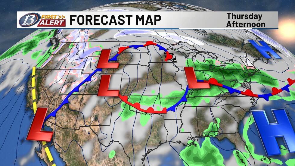
The system’s warm front should stay to our south into tomorrow, but there is still a little bit of uncertainty regarding how far north this feature gets/where the low tracks. The placement will dictate if we’re able to get into a more unstable atmosphere in the afternoon/evening. A level 1 marginal risk is in place for locations south of I-94, meaning there is an isolated chance for a stronger/severe storm. Areas south of I-90 have the best chance to see some thunderstorms, with a level 2 slight risk in place, allowing for at least a scattered chance of a few strong storms. Large hail and heavy rain will be the primary concerns, but a few higher wind gusts cannot be ruled out. Widespread rain is likely through the morning before the coverage turns scattered to even isolated tomorrow afternoon. Another wave of rain and thunderstorms will then work in during the evening. Temperatures should grasp the low 50s in the Chippewa Valley, with some warmer conditions in the Coulee Region with highs in the mid-upper 50s. The low will track east at night, bringing a colder feel to the area on Saturday. We’ll see decreasing clouds later in the day behind the outside chance of a stray rain or snow shower. When all is said and done, rainfall amounts of 0.50-1.00″ appear likely across much of the area. There may be some locally higher totals where heavy rain moves over the same locations. Warmer air returns with temperatures into the 60s both Sunday and Monday before we drop closer to normal by the middle of next week.
Copyright 2026 WEAU. All rights reserved.