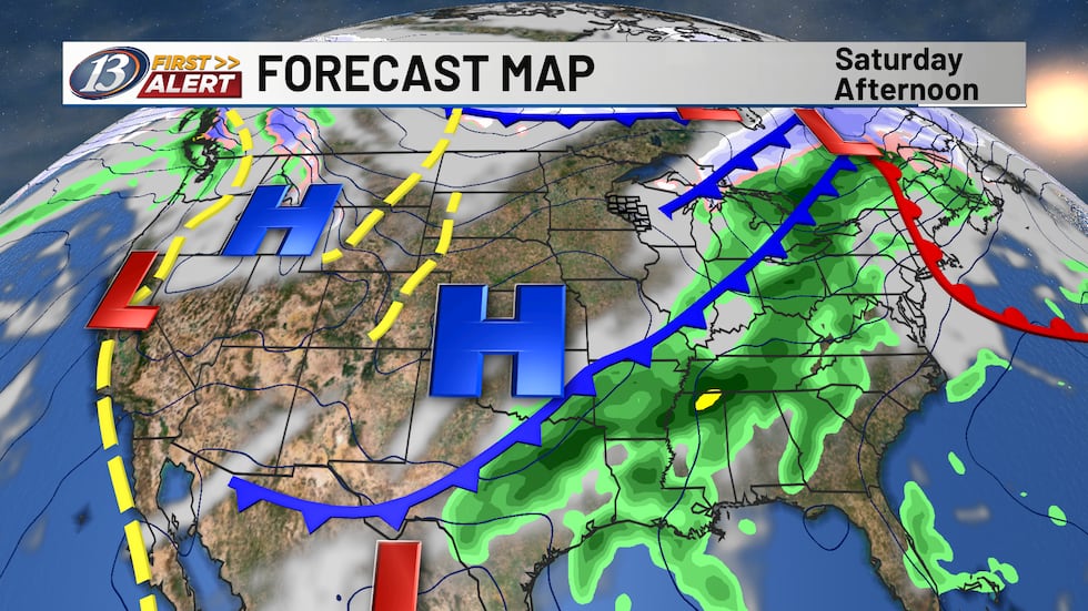
A few flurries possible as colder air seeps in for the beginning of the weekend
Activity is beginning to wane out there this morning as much colder air has arrived in Western Wisconsin. We’re seeing rain transition over to a wintry mix and snow, but overall impacts will be very minimal. Up to a coating will be possible for our most northern locations before the system moves into the rearview mirror. Winds will be breezy out of the northwest, keeping temperatures much colder compared to the past few days. We’ll eventually tap into some sunshine later in the afternoon. A wave will pass by to our north tonight, bringing a few clouds. Overall rain/snow chances should stay confined much further to the north. Breezy winds and cloud cover will keep overnight lows closer to average in the low to mid 30s.
A warm front comes into the picture on Sunday, allowing for our spring-like weather to return! We’re talking about the first 60s of the year in Western Wisconsin, which is 25 to nearly 30 degrees above average! Records are not in jeopardy, though, as the record in Eau Claire is 73 degrees (2000) and the record for La Crosse is 74 degrees (2000). Winds will turn more southwesterly with the passage, with blustery winds persisting. The adjacent cold front passes through on Monday, allowing for daytime highs to be slightly stunted but still above average in the 50s. The passage will be a dry one, as a few clouds will be overhead. With a wave passing by, a few isolated to scattered showers can’t be ruled out. Temperatures look to reach the 40s to close out next week.
Copyright 2026 WEAU. All rights reserved.